


District Four, DeKalb County, Alabama
About
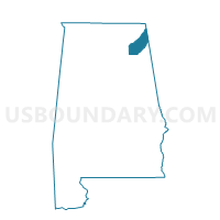
Outline

Summary
| Unique Area Identifier | 521676 |
| Name | District Four |
| County | DeKalb County |
| State | Alabama |
| Area (square miles) | 141.84 |
| Land Area (square miles) | 141.57 |
| Water Area (square miles) | 0.27 |
| % of Land Area | 99.81 |
| % of Water Area | 0.19 |
| Latitude of the Internal Point | 34.51377320 |
| Longtitude of the Internal Point | -85.80809720 |
Maps


Graphs
Select a template below for downloading or customizing gragh for District Four, DeKalb County, Alabama


Neighbors
Neighoring Voting District (by Name) Neighboring Voting District on the Map
- Dean's Chapel Community Center, Jackson County, AL
- District One, DeKalb County, AL
- District Three, DeKalb County, AL
- District Two, DeKalb County, AL
- Dutton City Hall, Jackson County, AL
- Macedonia School, Jackson County, AL
- Section City Hall, Jackson County, AL
Top 10 Neighboring County Subdivision (by Population) Neighboring County Subdivision on the Map
- Fort Payne CCD, DeKalb County, AL (19,055)
- Rainsville-Sylvania CCD, DeKalb County, AL (13,391)
- Section CCD, Jackson County, AL (7,095)
- Geraldine CCD, DeKalb County, AL (6,393)
- Ider CCD, DeKalb County, AL (5,937)
- Fyffe CCD, DeKalb County, AL (5,373)
- Collinsville CCD, DeKalb County, AL (4,498)
- Valley Head-Mentone CCD, DeKalb County, AL (4,304)
- Henagar CCD, DeKalb County, AL (3,530)
Top 10 Neighboring Place (by Population) Neighboring Place on the Map
- Fort Payne city, AL (14,012)
- Rainsville city, AL (4,948)
- Henagar city, AL (2,344)
- Sylvania town, AL (1,837)
- Fyffe town, AL (1,018)
- Powell town, AL (955)
- Hammondville town, AL (488)
- Pine Ridge town, AL (282)
- Shiloh town, AL (274)
Top 10 Neighboring Unified School District (by Population) Neighboring Unified School District on the Map
- DeKalb County School District, AL (57,097)
- Jackson County School District, AL (38,458)
- Fort Payne City School District, AL (14,012)
Top 10 Neighboring State Legislative District Lower Chamber (by Population) Neighboring State Legislative District Lower Chamber on the Map
- State House District 26, AL (52,448)
- State House District 24, AL (48,127)
- State House District 39, AL (46,905)
- State House District 23, AL (43,186)
Top 10 Neighboring State Legislative District Upper Chamber (by Population) Neighboring State Legislative District Upper Chamber on the Map
Top 10 Neighboring 111th Congressional District (by Population) Neighboring 111th Congressional District on the Map
Top 10 Neighboring Census Tract (by Population) Neighboring Census Tract on the Map
- Census Tract 9511, Jackson County, AL (7,095)
- Census Tract 9603, DeKalb County, AL (6,908)
- Census Tract 9604, DeKalb County, AL (6,483)
- Census Tract 9606, DeKalb County, AL (6,393)
- Census Tract 9601, DeKalb County, AL (5,937)
- Census Tract 9605, DeKalb County, AL (5,373)
- Census Tract 9608, DeKalb County, AL (4,498)
- Census Tract 9614, DeKalb County, AL (4,304)
- Census Tract 9609, DeKalb County, AL (3,809)
- Census Tract 9602, DeKalb County, AL (3,530)
Top 10 Neighboring 5-Digit ZIP Code Tabulation Area (by Population) Neighboring 5-Digit ZIP Code Tabulation Area on the Map
- 35967, AL (16,630)
- 35986, AL (7,744)
- 35961, AL (6,514)
- 35978, AL (5,390)
- 35971, AL (4,914)
- 35968, AL (4,575)
- 35765, AL (4,013)
- 35771, AL (3,645)
- 35989, AL (3,573)
- 35744, AL (2,570)